
Cartographic Design
Undergraduate Certificate
Cartographic design at CMU
Maps are powerful communication tools that help us understand the world. Modern maps are used to plan for infrastructure, business development, environmental protection, emergencies and more. Learn how to design and produce maps with an undergraduate certificate in cartographic design.
While it is open to all students, this certificate pairs well with majors in geography, geographic information sciences, art or graphic design.
Program Snapshot
Why earn a certificate in cartographic design?
This certificate program will teach you how to create accurate and visually appealing maps for regional planning, political, cultural and educational purposes.
Over five courses, you will learn how to:
- Gather, measure and classify spatial data.
- Utilize industry leading software like Adobe Creative Suite and Esri ArcGIS.
- Understand map symbols and scale.
- Create visually appealing graphic designs.
Highlights of our cartographic design certificate
By earning a certificate in cartographic design , you will:
- Stand out to employers: Combine this certificate with a relevant major and minor to stand out to employers in the fields of graphic design, geographic information science, city planning and environmental sciences.
- Participate in labs and research projects: You'll learn the art of map making by critiquing existing maps and creating your own. Previous students have even won national student awards for their maps!
- Add just five courses to your degree plan: Some of your courses may even "double count" toward your major or minor in graphic design, GIS, environmental studies and biology.
- Study at an Adobe Creative Campus: You'll have full access to video, audio, photo, editing and design software for free.
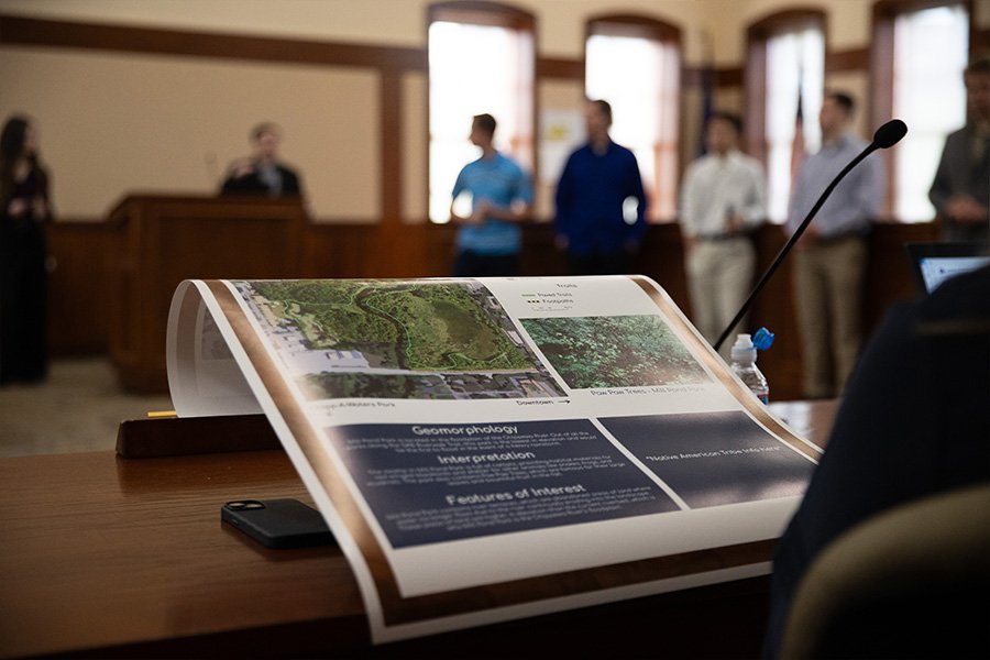
Students propose new maps and wayfinding signs for local parks
Geography and environmental studies students partnered with the City of Mount Pleasant to outfit local parks with new signs.
The students used Geographic Information Systems to gather information about park visitors and their needs. Then, they proposed a series of signs which showcased park maps, outlined rules, supplied educational information and provided location markers.
Their work helped welcome visitors and provide crucial navigational information to families and community members.
Request Information about CMU
By submitting this form, I agree to receive calls, emails and/or text messages from Central Michigan University to discuss furthering my education.